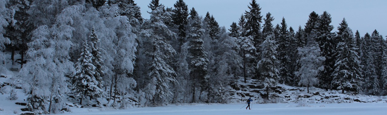


June 3, 2015. The second day of our Norwegian road trip, we awoke in Flåm bright and early, picked up the rental car, bought some hiking provisions, and headed ten minutes away to the town of Aurland.
First stop, the cute and comfy Vangsgaarden Guesthouse, where we were greeted by the house mascot (an adorable King Charles spaniel) and checked into our cozy room with a view of the fjord.
We then stuffed our packs with the trail food we’d purchased and headed out for our planned hike. Our goal was to do the last section of the three-day Aurlandsdalen Valley Trail — one of the treks Norwegians deem a “must do before you die.”
The eight-hour leg from Østerbø (2,700 feet above sea level) to Vassbygdi (165 feet above sea level) is one of the most famous hikes in Norway.
Sadly, the guesthouse proprietress informed us that heavy snows from the day before had left left their mark, so she urged us to call the Østerbø fjellstove (“mountain cabin”) for a conditions report. And of course, we discovered that the trailhead was closed.

Feeling glum, we still piled in the car anyway to see if we could find another hiking option. Alternating bouts of sleet and snow didn’t give us much encouragement.
But Matthew in his brilliance consulted the topographical map and discovered that our originally hoped-for trail crossed the road further down at a lower elevation.
We sped to the spot, parked our car by the roadside, and jumped over the guardrail to see what we could find. Knee-deep snow was the answer.
But the good news was that we could see a relatively snow-free, south-facing mountainside in front of us, so we slogged onwards, trying to track down the path.
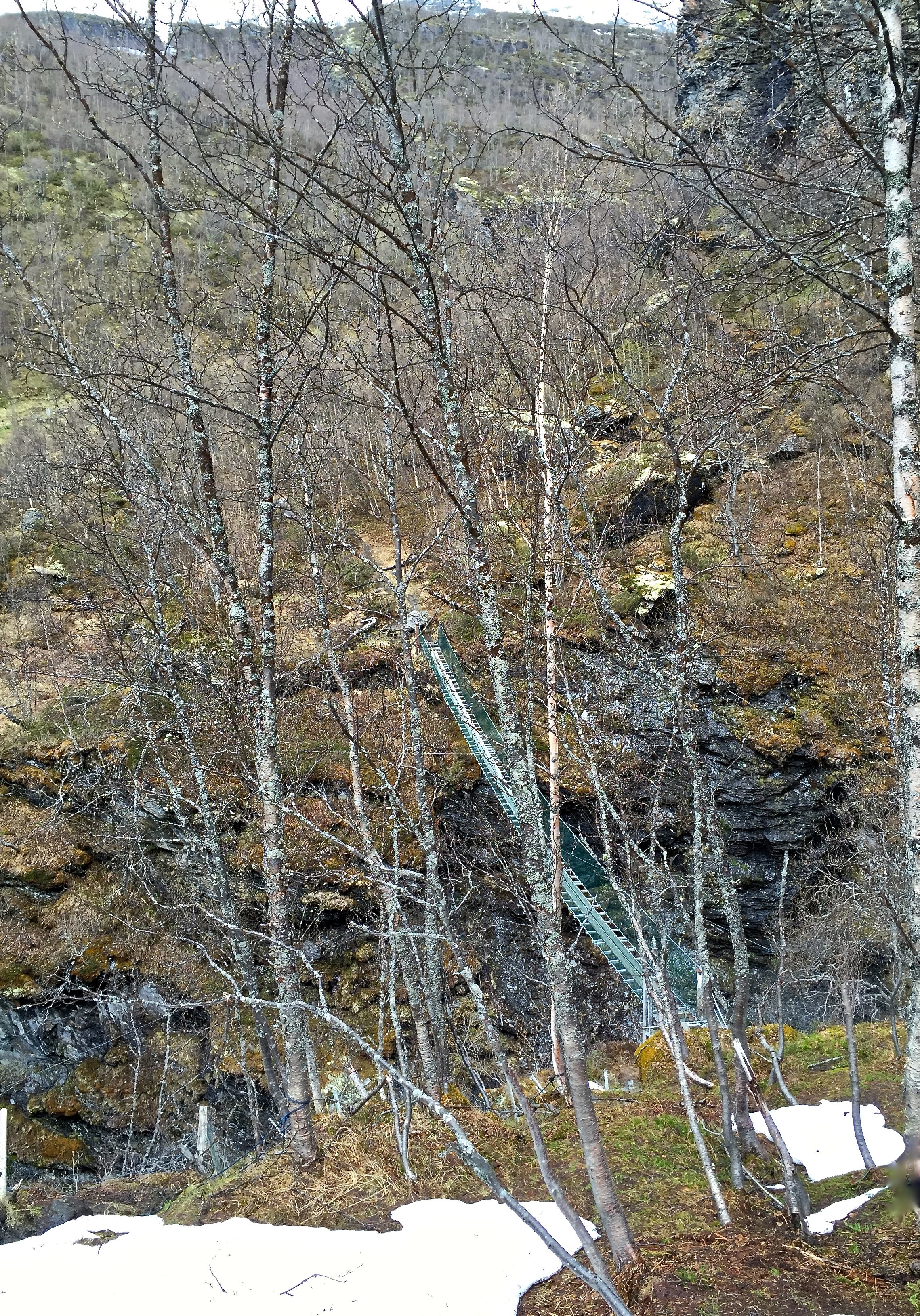
Eventually we spied a bit of well-trodden trail, thick with slush and mud, that led us to — joy of joys — a steep ravine.
More good news, the only way to cross the abyss was a tiny, rickety, suspension bridge that hung over the 75-foot drop. Did I mention I hate heights?
The Norwegian Trekking Association sign at the entrance made it clear that the catwalk could be crossed by only one person at a time.
Thanks for the heads-up, Mr. Signmaker. As if the bridge’s narrowness, disconcerting tendency to sway in the slightest breeze, and the fact that it was missing planks in spots wasn’t warning enough.
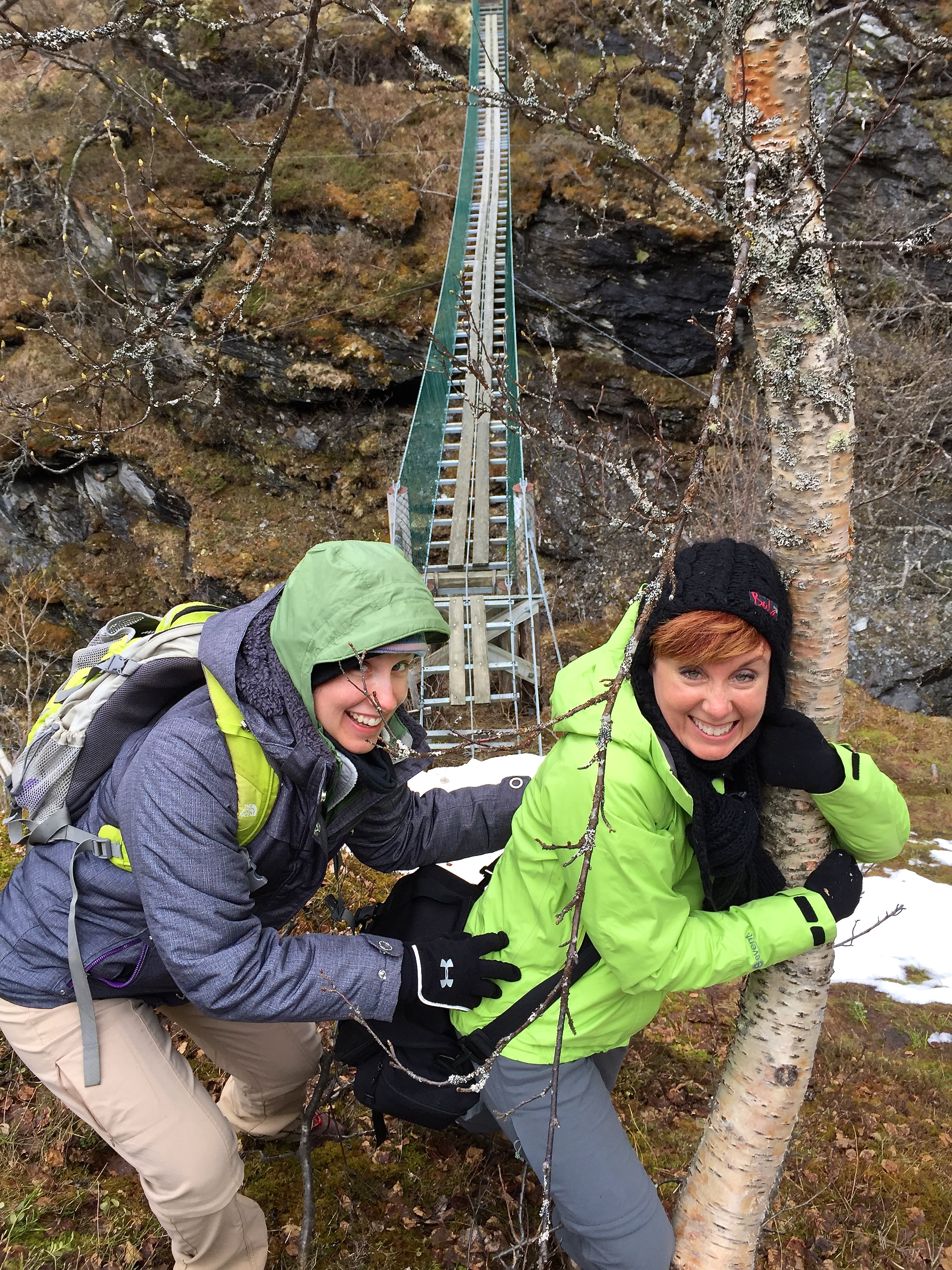
I graciously volunteered to go last, hoping to buy myself time to gain some courage or sneak a swig of whiskey before I took my turn.

We all agreed that, to divert our attention from our terror, we’d conduct a sing-a-long while crossing. Our battle hymn? Old MacDonald Had a Farm.
Everything went well, and Matthew and Ruthie arrived safely, but about halfway through my crossing, I ran out of animals.
I panicked and froze, eyes clinched shut, tears streaming down my face, and my legs shaking so hard that the bridge vibrated.
On the other side, Ruthie and Matthew stopped celebrating their survival and frantically started recycling animals, singing heartily, and shouting “Baby steps! Baby steps!”
I barely managed to pull it together and continue my snail’s pace across the bridge, finally arriving on the other side, where we all commenced congratulatory hugs and backslappings … but in my head I was wondering how in the heck would I ever be able to cross back again to get home?
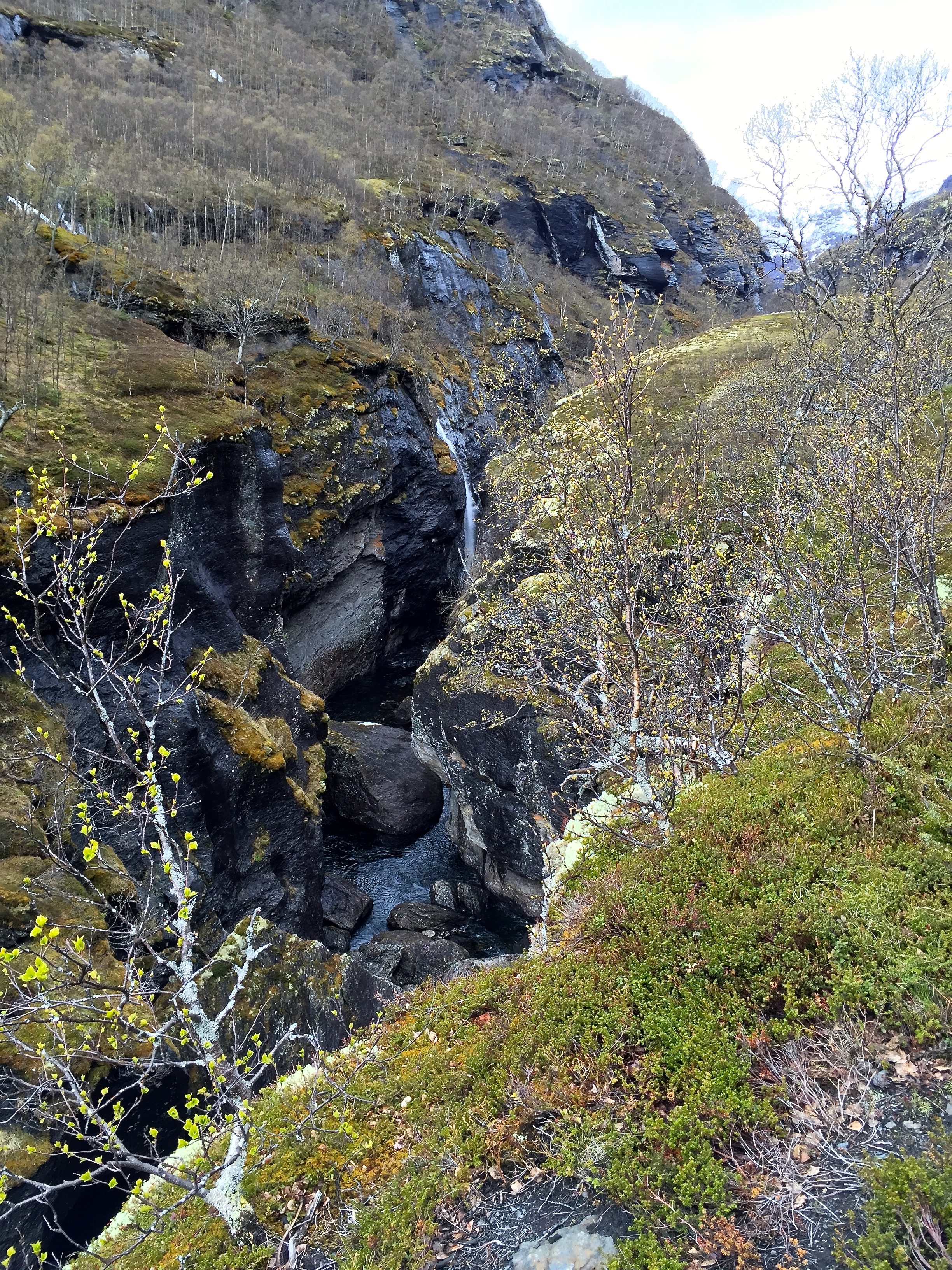
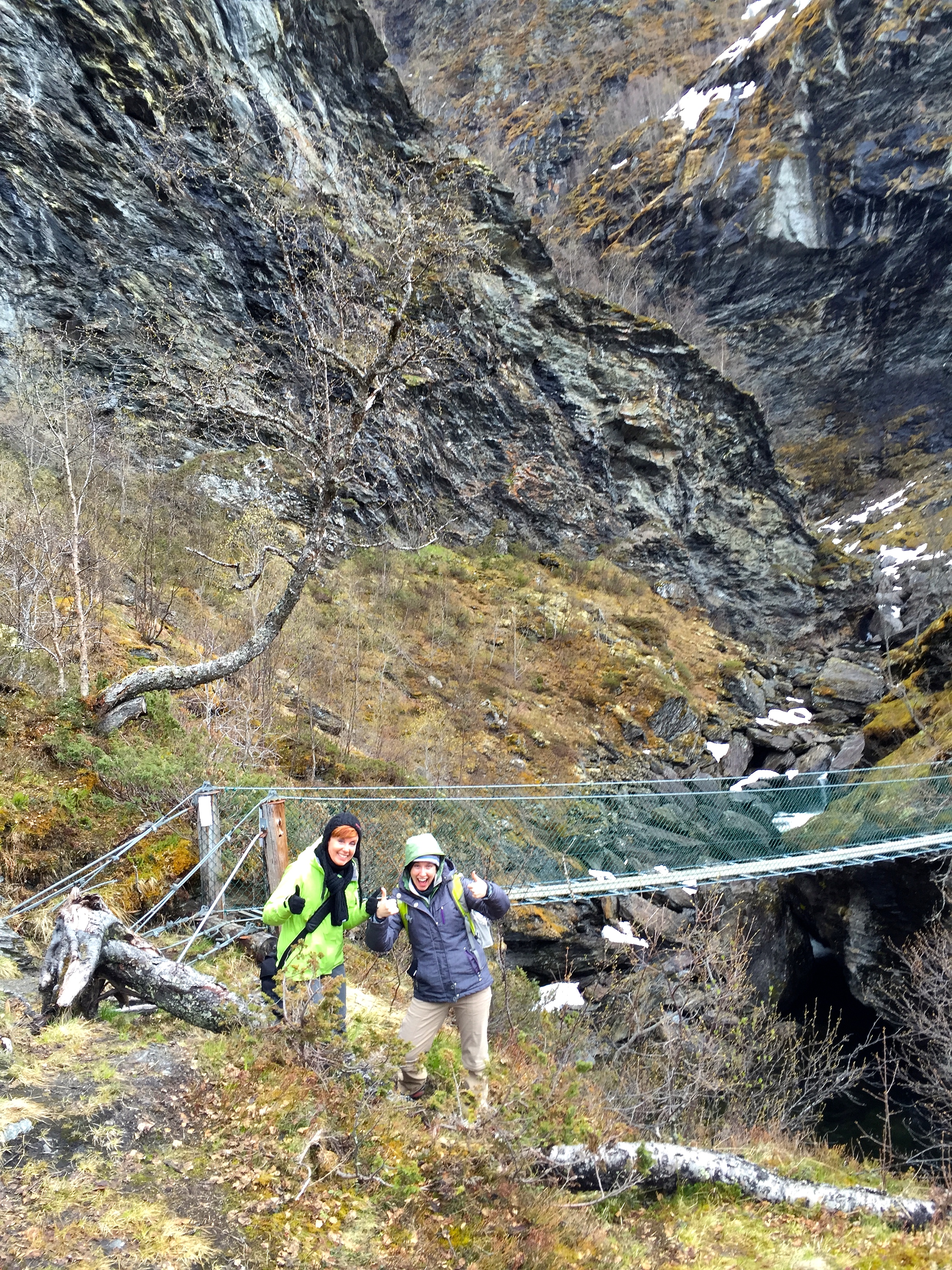
Putting that thought aside now that I was safe, I decided to take a closer peek at the actual gorge we’d just crossed. It looked like a giant slash in the earth, lasered into the landscape as if by a lightning strike, but I could see that a river far below had carved it.
My heart gradually stopped racing, and I began to enjoy the view of the rolling hillsides and the mountaintops beyond that shouldered a heavy load of snow from the night before.
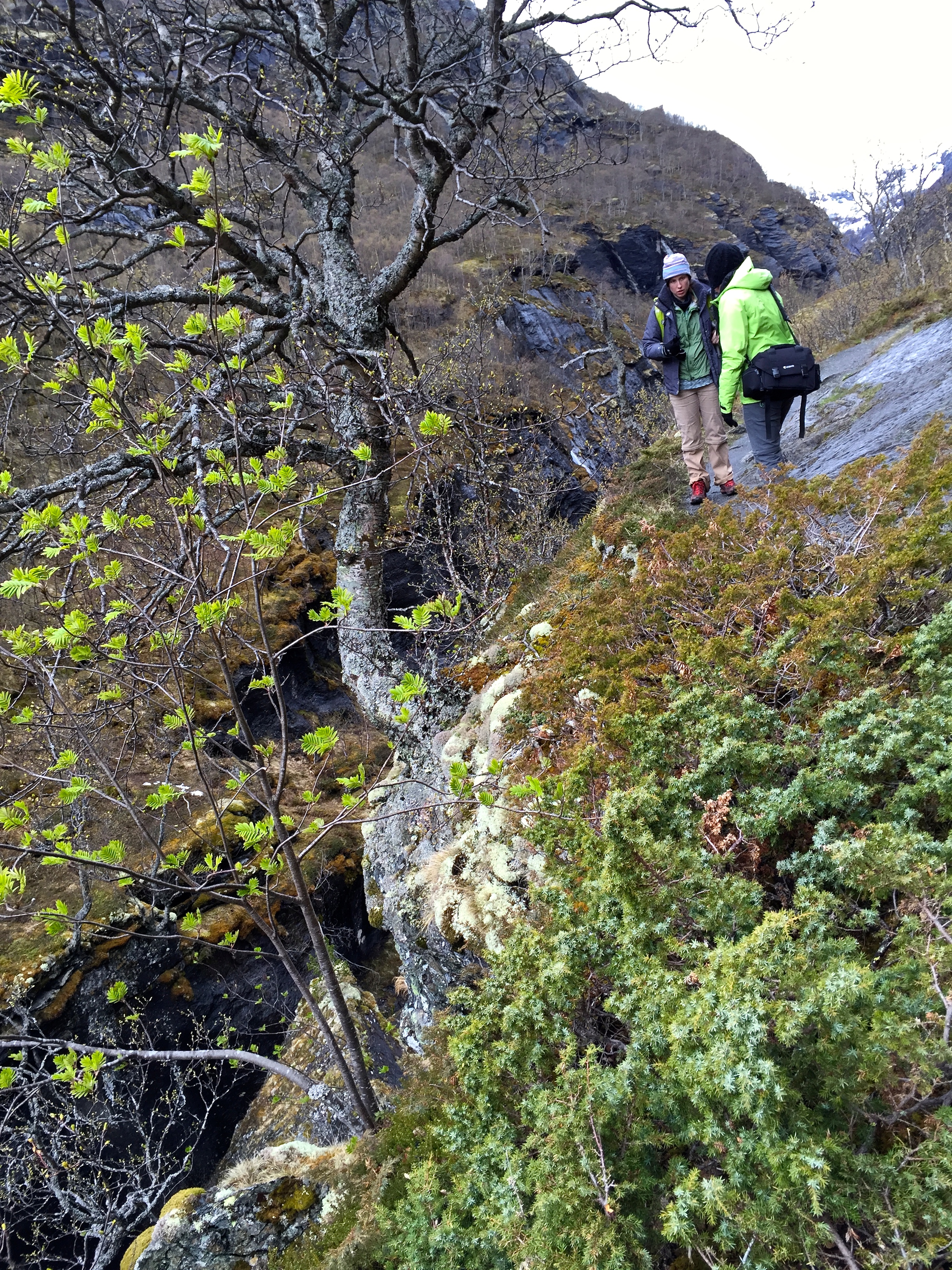
Although it continued to sleet in fits and spurts, we decided we’d come too far to turn back, so we cautiously plucked our way along the steep trail.
Every so often we stopped to peek over the cliff edge, which made our stomachs drop, so we distracted ourselves by taking photos of beautiful alpine plants along the pathway.
I don’t know all their names, but I created a gallery below to honor these brave little harbingers of spring (although technically it’s almost summer.)


Eventually, the trail leveled out and continued along the riverbank for a while, giving our knees a much-needed break.
The air smelled of ozone and earth from the persistent freezing drizzle, and our breath wafted out in little steaming puffs. Mountains in the background still wore their lambswool capes, but all around us, green worked to carpet the rocks and climb up the trees.
The view just got better and better, making us scamper like rabbits to see what was around the next bend. Take a look at the gallery below for some of the awesome vistas we spied along the way. (Just click on the images for bigger views.)


At one point, we rounded an outcropping of rock and entered a little hollow that was walled in by craggy, moss-covered boulders.
They huddled in a circle, looking a bit like trolls hunched over a fire, but a blackwater pond rather than flames stood in their center. Reeds waded at the pool’s edges and a cluster of leafless birches mourned along the shoreline. Pretty, but moody.
Ruthie and I decided it looked exactly like a fairy glen, a place where we could expect to witness a nekk (a water sprite known for drowning men) rising from the depths.
Nekks and Huldras were just a few of the many creepy creatures that Ruthie and I had seen featured in an exhibition of Norwegian folk art at the National Gallery — seems like benevolent fairy tale characters must be in short supply here.

Shaking off our fantasy, we left the glade and continued along the footpath, passing another blackwater pool that reflected the snow-covered mountains beyond.
Not far away, a grassy ledge hosted two ancient wooden cabins, probably once used by sheep herders but now likely serving as one of the hiker’s respites maintained by the trekking association.
We decided to go over and investigate, but the sturdy wooden footbridge crossing the gorge was blocked with ropes, maybe because the cabin hadn’t yet been stocked with supplies.

We traipsed along a bit further and came to a fork in the road with a signpost pointing us towards Vetlahelvete Cave, which we affectionately nicknamed Velveeta Cave for lack of better pronunciation skills.
As it turns out, Vetla is the local dialect for “little” while helvete means “Hell.” Sounds promising, right? But the photos we’d seen earlier showed a dramatic slot canyon that was the reason we’d the picked this particular hike.
A brief walk brought us to a stone-paved bluff with a boardwalk that lead down across a boggy plain to the mouth of the cave.Several ice-covered steps brought us up and into the cave’s entrance.
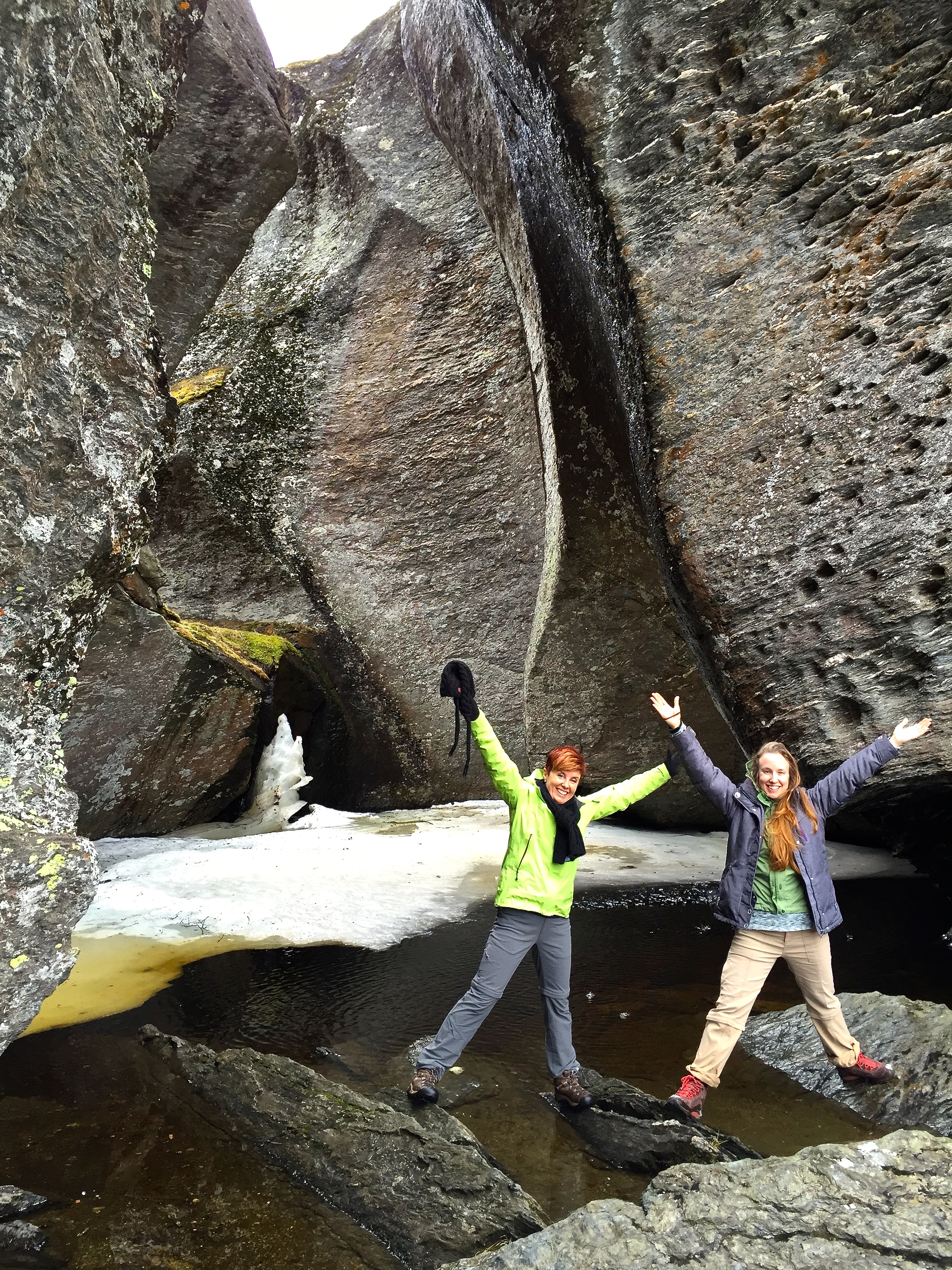
It was just as pictured. Monolithic rocks sculpted by glaciers formed the walls, which resembled rows of giant molars. In the center, a big sheet of ice floated in a pool of meltwater that had collected. Several chunks had broken off to hunker like icebergs in the puddle.
We tested the acoustics and listened to echoes rebound around the space, then we plopped ourselves down on a log bench and ate our lunch, listening to the drip, drip, drip from the cave walls.


Our return hike went much faster than anticipated (it always feels shorter going home), and even the bridge wasn’t as bad the second time around.
Back in town, we rewarded ourselves with a couple of beers and a lovely meal at the Duehuset Pub — yummy lamb for me, trout for Matthew, and salmon for Ruthie. And on that note, I leave you with a few photos of the cute town of Aurland, where we bedded down for the night.


Just gorgeous!
LikeLike
looks fab im looking at doing it this year how long did it take you and did you find the path easy?
LikeLike
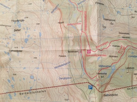
Hey there! We did just the last leg of the 3-day hike; and only a portion of this last leg because we couldn’t get all the way up the mountain due to snow (in June). So we parked our car by the side of the road at the second tunnel past the town of Aurland, then we hopped the guardrail. The trail is both easy to follow and easy to hike; you don’t have to be a mountaineer. It took us four hours to hike to Vetlahelvete and back to the car, with lots of photographing along the way. If you don’t have snow, I’d recommend the whole third leg of the journey, which takes about 5-6 hours. You start at the Østerbø mountain hotel, then hike all the way down to Vassbygdi. The hotel then has a bus that will pick you up in Vassbygdi and take you back to your car at the hotel. For more details on the hike, check out this site: http://www.fjords.com/aurlandsdalen1999.shtml
And to contact the hotel for a room and/or bus pickup from the bottom of the trail, their info is:
Østerbø Fjellstove AS
5745 Aurland
post@aurlandsdalen.com
Tlf: +47 57 63 11 77
Fax: (summer) +47 57 63 11 52 / (winter) +47 22 26 96 21
Hope you have fun!
LikeLiked by 1 person
thank was loads of help thanks ever so much. id love to do the whole 6 hours but i dont think we booked enough time there so was hoping for a few hours walk at least
LikeLike
You’re welcome — and I bet you could do the hike from the road, to the cave, and back again in three hours if you didn’t dawdle like we did. Enjoy!
LikeLiked by 1 person
thanks thats the plan hopefully was it easy to find the path down from the road?
LikeLike
Hey there — I just posted a hiking map at the bottom of the “Vetlahelvete Cave” post with directions for you. It shows Route 50, the two tunnels, the parking lot, the trails, and Vetlahelvete cave. Take a look — hope this makes it a little easier to find. You can try printing it out from my blog, but if it doesn’t work and you want your own map bigger map, you can find them in any of the DNT offices in any city in Norway. You’d ask them for the hiking map for “Aurlandsdalen.” Good luck!
LikeLiked by 1 person