
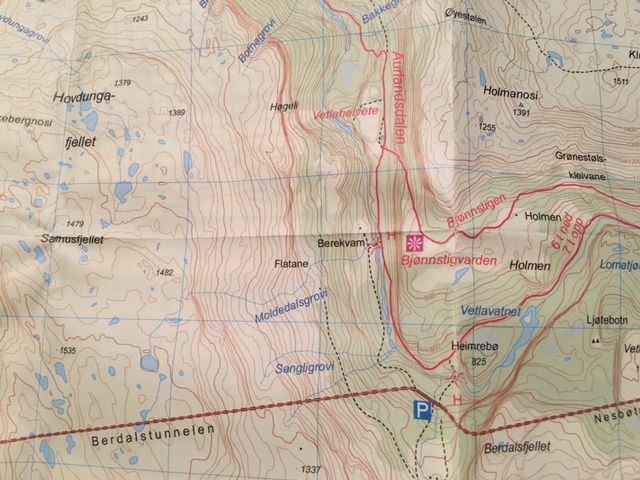
or my “walking south wales” reader — here’s the map I mentioned. In this image, you’d be coming along Route 50 by car from Aurland, which is off the map to the left. So as you can see, going from left to right, you’d go through the Berdalstunnelen (Berdals tunnel) first. Then right before you get to to the Nesbotunnelen (Nesbo tunnel), you’ll see the parking lot. (It’s the big blue P here.) Park there, and cross the road, and you’ll see the trail off to your left. There are actually two trails that cross the road, which appear as dotted lines. I’d take the trail on the right, that goes over the bridge near Heimrebo. The bridge is marked with red brackets on this map, and you’ll physically see it once you walk down the trail a bit — it’s the narrow suspended footbridge in my pictures. (The other trail on the left leads to the Berekvam bridge, which was broken the last time we hiked this, so I wouldn’t go that way.) So if you cross the bridge at Heimrebo, then you’ll follow the really big trail to your left (it’s the big red line that looks like a road), and continue to Vetlahelvete, which is marked in red at the top of this map; it’s perpendicular to the vertical word Aurlandsdalen. Hope this helps! Have fun!
